


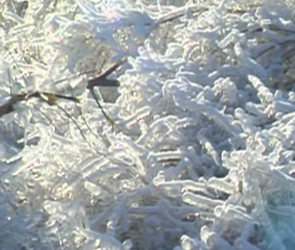


The National Weather Service has issued an ice storm warning effective until noon Thursday. Precipitation in the form of freezing rain and drizzle will increase in intensity overnight as a large-scale weather disturbance moves over the region. Through this evening and overnight, expect precipitation rates to increase with ice accumulation becoming more efficient with time. In total, two to three tenths of an inch of additional ice accumulation is possible through the overnight, before precipitation changes to light snow Thursday morning. Travel will likely become very hazardous this evening and overnight, especially if rain becomes detrimental to ongoing and future road surface treatment efforts. Additionally, strong northwest winds will overspread the region Thursday morning which will lead to added stress on power lines and branches, which may cause localized power outages across the warned area.
WHAT…Significant icing. Ice accumulations of two to three
tenths of an inch are expected, with snow accumulations of up to
a half inch possible Thursday morning. Winds will gust as high
as 35 mph Thursday morning with gusty winds expected to continue
into the afternoon hours.
WHERE…Portions of east central and northeast Kansas and
central, north central, northeast, northwest and west central
Missouri.
WHEN…Until noon CST Thursday.
ADDITIONAL DETAILS…Power outages and tree damage are likely
due to the ice. Travel could be nearly impossible. The
hazardous conditions could impact the morning or evening
commute.
An Ice Storm Warning means significant amounts of ice
accumulation will make travel dangerous or impossible. Travel is
strongly discouraged. If you must travel, keep an extra
flashlight, food and water in your vehicle in case of an
emergency. Snapped power lines and falling tree branches are also
possible.